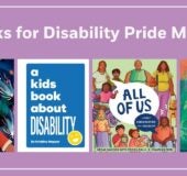
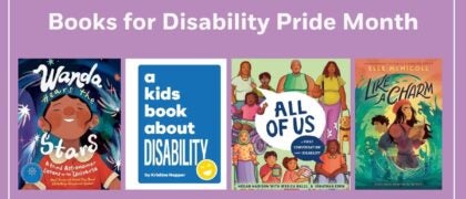
Discover and explore the U.S.A. in the fully updated seventh edition of this award-winning atlas, created especially for kids by the world-renowned National Geographic cartographers.

Celebrate America’s grandeur and diversity with more than 75 National Geographic maps, more than 350 color images, 50-plus attention-grabbing graphics, and more. Each state has its own detailed, easy-to-read map plus a brief essay, facts at a glance about population, state capital, statehood date, and the state flag, bird, and flower, as well as highlights unique to the state.

Physical maps of each geographic region make it easy to see the mountains, rivers, lakes, deserts, and prairies that make up America’s diverse landscape. Vibrant, full-color photo essays bring each region to life. 

Every statistic in every fact box, every statement in every essay, and every symbol on every map has been carefully researched to ensure that the National Geographic Kids United States Atlas provides the most accurate, up-to-date information available.

Count on National Geographic to bring you the very best U.S. atlas for school and family use. The perfect reference for kids to learn about all 50 states, U.S. territories, and Washington, D.C.!
NATIONAL GEOGRAPHIC and maps go together like latitude and longitude. For more than 130 years, National Geographic maps have helped spread geographic knowledge to people around the world. Eye-catching graphic elements give the maps their distinctive look and enhance their readability. National Geographic combines the latest data gathered by space-age technology with innovative mapping techniques to create state-of-the-art political, physical, and thematic maps. Meticulous research and attention to detail have established a standard of excellence that is recognized worldwide.

WRITER/EXPERT: Judith M. Painter is a 30-year veteran geography and social studies educator in Salem, Virginia. With the Virginia Geographic Alliance, she has been active in geographic education for her students, pre-service educators, and practicing educators. Becoming a National Geographic 2018 Grosvenor Teacher Fellow pushed her to actively promote outdoor education and local-to-global exploration with her students. She encourages her students to not only be learners, but also to explore and teach others about their world.
additional book photo

About

Discover and explore the U.S.A. in the fully updated seventh edition of this award-winning atlas, created especially for kids by the world-renowned National Geographic cartographers.

Celebrate America’s grandeur and diversity with more than 75 National Geographic maps, more than 350 color images, 50-plus attention-grabbing graphics, and more. Each state has its own detailed, easy-to-read map plus a brief essay, facts at a glance about population, state capital, statehood date, and the state flag, bird, and flower, as well as highlights unique to the state.

Physical maps of each geographic region make it easy to see the mountains, rivers, lakes, deserts, and prairies that make up America’s diverse landscape. Vibrant, full-color photo essays bring each region to life. 

Every statistic in every fact box, every statement in every essay, and every symbol on every map has been carefully researched to ensure that the National Geographic Kids United States Atlas provides the most accurate, up-to-date information available.

Count on National Geographic to bring you the very best U.S. atlas for school and family use. The perfect reference for kids to learn about all 50 states, U.S. territories, and Washington, D.C.!

Author

NATIONAL GEOGRAPHIC and maps go together like latitude and longitude. For more than 130 years, National Geographic maps have helped spread geographic knowledge to people around the world. Eye-catching graphic elements give the maps their distinctive look and enhance their readability. National Geographic combines the latest data gathered by space-age technology with innovative mapping techniques to create state-of-the-art political, physical, and thematic maps. Meticulous research and attention to detail have established a standard of excellence that is recognized worldwide.

WRITER/EXPERT: Judith M. Painter is a 30-year veteran geography and social studies educator in Salem, Virginia. With the Virginia Geographic Alliance, she has been active in geographic education for her students, pre-service educators, and practicing educators. Becoming a National Geographic 2018 Grosvenor Teacher Fellow pushed her to actively promote outdoor education and local-to-global exploration with her students. She encourages her students to not only be learners, but also to explore and teach others about their world.

Photos

additional book photo

Books for Asian American and Native Hawaiian/Pacific Islander Heritage Month

Every May we celebrate the rich history and culture of Asian Americans, Native Hawaiians, and Pacific Islanders. Browse a curated selection of fiction and nonfiction books by AANHPI creators that we think your students will love. Find our collection of titles here: Elementary School

Read more

PRH Education Translanguaging Collections

Translanguaging is a communicative practice of bilinguals and multilinguals, that is, it is a practice whereby bilinguals and multilinguals use their entire linguistic repertoire to communicate and make meaning (García, 2009; García, Ibarra Johnson, & Seltzer, 2017)   It is through that lens that we have partnered with teacher educators and bilingual education experts, Drs.

Read more

PRH Education Classroom Libraries

“Books are a students’ passport to entering and actively participating in a global society with the empathy, compassion, and knowledge it takes to become the problem solvers the world needs.” –Laura Robb   Research shows that reading and literacy directly impacts students’ academic success and personal growth. To help promote the importance of daily independent

Read more