Download high-resolution image Look inside
Listen to a clip from the audiobook
audio pause button
0:00
0:00

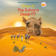
Where Is the Sahara Desert?

Part of Where Is?

Illustrated by David Malan
Look inside
Listen to a clip from the audiobook
audio pause button
0:00
0:00
Ten-story-high sand dunes, eye-tricking mirages, unlucky explorers – it’s all here and more in this newest Where Is? book.

From the #1 New York Times Best-Selling Who Was? series comes Where Is?, a series that tells the stories of world-famous landmarks and natural wonders and features a fold-out map!


Imagine over three million square miles of sand dunes that are as tall as a ten-story building. That place is real -- it's the Sahara Desert! Vast, yes! And home to fascinating creatures such as ostriches and fennec foxes as well as amazing plant life. The shallow roots of the mesquite tree can grow almost 200 feet across to absorb water. Readers will also learn about the famous trade routes of the past with caravans of up to 10,000 camels, European explorers to the region (some very unlucky ones), and native populations like the Berber and Tuareg, the faces of the men are blue from the dye in the veils they always wear.
Sarah Fabiny is an author and editor living in New York City. View titles by Sarah Fabiny
Who HQ is your headquarters for history. The Who HQ team is always working to provide simple and clear answers to some of our biggest questions. From Who Was George Washington? to Who Is Michelle Obama?, and What Was the Battle of Gettysburg? to Where Is the Great Barrier Reef?, we strive to give you all the facts. Visit us at WhoHQ.com View titles by Who HQ
Where is the Sahara Desert?

 
Ancient Egypt was one of the greatest, most powerful, and most stable civilizations in the history of the world. It lasted for over three thousand years, from 3150 BCE to 30 BCE.
 
The ancient Egyptians invented many things that we still use today, including ways to construct buildings and irrigate land, paper and ink, clocks, the toothbrush and toothpaste, and even breath mints.
 
While the kingdom of ancient Egypt was very strong, it wasn’t nearly as large as other ancient civilizations, like the Greek or Roman empires.
 
 The ancient Egyptians established their kingdom in the strip of land that ran alongside the Nile River in northeast Africa.
 
The Nile River provided water, food, and transportation for the citizens of the kingdom. But beyond the banks of the Nile River lay arid, or dry, land—­the Sahara Desert. To the east, it stretched a few hundred miles to the Red Sea. To the west, it extended for thousands of miles, all the way to the Atlantic Ocean.
 
The Egyptians called the barren desert the “red land.” Although no crops could be grown there, it was still important to the ancient Egyptians. The miles of hot sand separated and protected the kingdom from invading armies. It also provided the ancient Egyptians with valuable natural resources. They used the rock and stone for monumental structures such as the pyramids. Semiprecious stones, such as malachite and turquoise, were used in their beautiful jewelry. And metals, like copper and gold, were transformed into tools and jewelry.
 
The ancient Egyptians could not live in the Sahara Desert. But they saw the miles and miles of this harsh landscape as an important and essential part of their lives and their civilization. The Sahara Desert is still as barren, dry, and arid as it was during the times of ancient Egypt. And it is still an important and essential part of our world.
 
  
Chapter 1: From Jungle to Desert

 
Imagine a place where you can walk for hundreds, even thousands, of miles and see only sand. A place that only gets a couple of inches of rainfall a year. That place exists, and it is the Sahara—­the largest hot desert in the world. (Antarctica and the Arctic are larger deserts, but they are cold deserts.)
 
The Sahara is located in the northern part of the African continent. This huge desert lies within the Northern Hemisphere and runs through ten countries: Algeria, Chad, Egypt, Libya, Mali, Mauritania, Morocco, Niger, Sudan, and Tunisia, as well as a part of Africa known as Western Sahara. It extends more than three thousand miles from the Atlantic Ocean in the west to the Red Sea in the east. It stretches over one thousand miles from the Mediterranean Sea in the north to the Sahel savanna in the south. (The Sahel savanna is an area of grassland.) The Sahara covers a total of about 3.5 million square miles. That’s approximately the same size as the United States.
 
On a summer day, the Sahara is among the hottest regions in the world. Temperatures often reach more than 120 degrees Fahrenheit. One of the hottest temperatures ever recorded on the planet was in the Sahara: In September 1922, the temperature hit 136.4 degrees Fahrenheit. That’s hot enough to cook a steak to medium rare! But the temperature drops drastically at night. It can get very cold, and maybe even go below freezing in winter.
 
This vast desert is like a huge laboratory for scientists. They have studied and learned a lot about this region. But the one thing scientists have not been able to determine is exactly when the Sahara Desert was created. Some scientists think that the desert first appeared five to seven million years ago. During this time, some of the plates that make up the earth’s surface collided and created the Alps. These mountains, along with the Himalayan mountains to the east, blocked winds that had once carried rain to the Sahara region. The area became very dry, and a desert was formed.
 
Other scientists believe the Sahara was originally formed around two to three million years ago during one of the ice ages that occurred on our planet. During this time, less rain fell on certain areas, including the Sahara region. As a result, the area dried out and eventually became a desert. And there are some scientists who suggest the Sahara first appeared during the last ice age, only tens of thousands of years ago. They believe that up until that time, this area always had a moist climate.
 
Scientists don’t agree on when the Sahara Desert was first formed. But most agree that this dry, hot place was actually lush and green only about four thousand years ago. It was full of animal and plant life.
 
These scientists believe that the Sahara’s climate switches back and forth about every twenty thousand years. It goes from a dry climate to a wet climate that allows plants and animals to thrive. And right now, the Sahara is in the desert phase. Scientists think that about eleven thousand years ago, monsoon rains came to this region in Africa. The area was covered with lakes, rivers, grasslands, and even forests. All kinds of animals lived in this green area. Hippos, giraffes, and elephants grazed in the grasslands, and fish and crocodiles swam in the rivers and lakes. It certainly would have looked very different than it does now.
 
But what caused this drastic change? It’s believed that the earth tilted slightly on its axis about eleven thousand years ago. This tilting meant that the Northern Hemisphere was slightly closer to the sun, which increased the amount of rain brought to the region.
 
But then, about eight thousand years ago, the earth tilted on its axis again. So the Northern Hemisphere was a bit farther away from the sun. It received less summer sunlight and less rain, so the region of the Sahara began to dry up. What was once green became arid and dusty.
 
There are some scientists who believe that human beings and their livestock were also part of the reason for the change in the Sahara’s landscape back then. People moved farther into the area and brought their animals with them. The animals, such as cows and goats, grazed on the grass and plants. The area was already drying out, but now there were fewer plants to hold the moisture and soil in place. The ground dried out and the dry soil blew away. What was once the lush green Sahara became the Sahara Desert in just a few hundred years.

About

Ten-story-high sand dunes, eye-tricking mirages, unlucky explorers – it’s all here and more in this newest Where Is? book.

From the #1 New York Times Best-Selling Who Was? series comes Where Is?, a series that tells the stories of world-famous landmarks and natural wonders and features a fold-out map!


Imagine over three million square miles of sand dunes that are as tall as a ten-story building. That place is real -- it's the Sahara Desert! Vast, yes! And home to fascinating creatures such as ostriches and fennec foxes as well as amazing plant life. The shallow roots of the mesquite tree can grow almost 200 feet across to absorb water. Readers will also learn about the famous trade routes of the past with caravans of up to 10,000 camels, European explorers to the region (some very unlucky ones), and native populations like the Berber and Tuareg, the faces of the men are blue from the dye in the veils they always wear.

Author

Sarah Fabiny is an author and editor living in New York City. View titles by Sarah Fabiny
Who HQ is your headquarters for history. The Who HQ team is always working to provide simple and clear answers to some of our biggest questions. From Who Was George Washington? to Who Is Michelle Obama?, and What Was the Battle of Gettysburg? to Where Is the Great Barrier Reef?, we strive to give you all the facts. Visit us at WhoHQ.com View titles by Who HQ

Excerpt

Where is the Sahara Desert?

 
Ancient Egypt was one of the greatest, most powerful, and most stable civilizations in the history of the world. It lasted for over three thousand years, from 3150 BCE to 30 BCE.
 
The ancient Egyptians invented many things that we still use today, including ways to construct buildings and irrigate land, paper and ink, clocks, the toothbrush and toothpaste, and even breath mints.
 
While the kingdom of ancient Egypt was very strong, it wasn’t nearly as large as other ancient civilizations, like the Greek or Roman empires.
 
 The ancient Egyptians established their kingdom in the strip of land that ran alongside the Nile River in northeast Africa.
 
The Nile River provided water, food, and transportation for the citizens of the kingdom. But beyond the banks of the Nile River lay arid, or dry, land—­the Sahara Desert. To the east, it stretched a few hundred miles to the Red Sea. To the west, it extended for thousands of miles, all the way to the Atlantic Ocean.
 
The Egyptians called the barren desert the “red land.” Although no crops could be grown there, it was still important to the ancient Egyptians. The miles of hot sand separated and protected the kingdom from invading armies. It also provided the ancient Egyptians with valuable natural resources. They used the rock and stone for monumental structures such as the pyramids. Semiprecious stones, such as malachite and turquoise, were used in their beautiful jewelry. And metals, like copper and gold, were transformed into tools and jewelry.
 
The ancient Egyptians could not live in the Sahara Desert. But they saw the miles and miles of this harsh landscape as an important and essential part of their lives and their civilization. The Sahara Desert is still as barren, dry, and arid as it was during the times of ancient Egypt. And it is still an important and essential part of our world.
 
  
Chapter 1: From Jungle to Desert

 
Imagine a place where you can walk for hundreds, even thousands, of miles and see only sand. A place that only gets a couple of inches of rainfall a year. That place exists, and it is the Sahara—­the largest hot desert in the world. (Antarctica and the Arctic are larger deserts, but they are cold deserts.)
 
The Sahara is located in the northern part of the African continent. This huge desert lies within the Northern Hemisphere and runs through ten countries: Algeria, Chad, Egypt, Libya, Mali, Mauritania, Morocco, Niger, Sudan, and Tunisia, as well as a part of Africa known as Western Sahara. It extends more than three thousand miles from the Atlantic Ocean in the west to the Red Sea in the east. It stretches over one thousand miles from the Mediterranean Sea in the north to the Sahel savanna in the south. (The Sahel savanna is an area of grassland.) The Sahara covers a total of about 3.5 million square miles. That’s approximately the same size as the United States.
 
On a summer day, the Sahara is among the hottest regions in the world. Temperatures often reach more than 120 degrees Fahrenheit. One of the hottest temperatures ever recorded on the planet was in the Sahara: In September 1922, the temperature hit 136.4 degrees Fahrenheit. That’s hot enough to cook a steak to medium rare! But the temperature drops drastically at night. It can get very cold, and maybe even go below freezing in winter.
 
This vast desert is like a huge laboratory for scientists. They have studied and learned a lot about this region. But the one thing scientists have not been able to determine is exactly when the Sahara Desert was created. Some scientists think that the desert first appeared five to seven million years ago. During this time, some of the plates that make up the earth’s surface collided and created the Alps. These mountains, along with the Himalayan mountains to the east, blocked winds that had once carried rain to the Sahara region. The area became very dry, and a desert was formed.
 
Other scientists believe the Sahara was originally formed around two to three million years ago during one of the ice ages that occurred on our planet. During this time, less rain fell on certain areas, including the Sahara region. As a result, the area dried out and eventually became a desert. And there are some scientists who suggest the Sahara first appeared during the last ice age, only tens of thousands of years ago. They believe that up until that time, this area always had a moist climate.
 
Scientists don’t agree on when the Sahara Desert was first formed. But most agree that this dry, hot place was actually lush and green only about four thousand years ago. It was full of animal and plant life.
 
These scientists believe that the Sahara’s climate switches back and forth about every twenty thousand years. It goes from a dry climate to a wet climate that allows plants and animals to thrive. And right now, the Sahara is in the desert phase. Scientists think that about eleven thousand years ago, monsoon rains came to this region in Africa. The area was covered with lakes, rivers, grasslands, and even forests. All kinds of animals lived in this green area. Hippos, giraffes, and elephants grazed in the grasslands, and fish and crocodiles swam in the rivers and lakes. It certainly would have looked very different than it does now.
 
But what caused this drastic change? It’s believed that the earth tilted slightly on its axis about eleven thousand years ago. This tilting meant that the Northern Hemisphere was slightly closer to the sun, which increased the amount of rain brought to the region.
 
But then, about eight thousand years ago, the earth tilted on its axis again. So the Northern Hemisphere was a bit farther away from the sun. It received less summer sunlight and less rain, so the region of the Sahara began to dry up. What was once green became arid and dusty.
 
There are some scientists who believe that human beings and their livestock were also part of the reason for the change in the Sahara’s landscape back then. People moved farther into the area and brought their animals with them. The animals, such as cows and goats, grazed on the grass and plants. The area was already drying out, but now there were fewer plants to hold the moisture and soil in place. The ground dried out and the dry soil blew away. What was once the lush green Sahara became the Sahara Desert in just a few hundred years.

Reading with Purpose Summit Event

On Monday, June 10th, Penguin Random House Education and DK Learning co-hosted a Reading with Purpose Summit Event in collaboration with Molly Ness, PhD. The event took place at Penguin Random House’s NYC headquarters and included sessions featuring leading education experts and a lunchtime author panel. The in-person professional learning event was built to show

Read more

2024 Elementary School Collection

The Penguin Random House Education Elementary School Collection features outstanding fiction, nonfiction, and picture books from Penguin Young Reader’s, Random House Children’s, DK, and Grupo Editorial, as well as children’s publishers distributed by Penguin Random House. Explore online or download this valuable resource to discover great books in specific topic areas such as: Leveled Readers,

Read more

DK Learning Phonic Books Sampler Request

Thank you for your interest in DK Learning | Phonic Books. To download the DK Learning | Phonic Books sampler with four complete readers, please click here and complete the form. Once your information is successfully submitted, a link to download the sampler will be provided on the confirmation screen.   Click here to learn

Read more

PRH Education Translanguaging Collections

Translanguaging is a communicative practice of bilinguals and multilinguals, that is, it is a practice whereby bilinguals and multilinguals use their entire linguistic repertoire to communicate and make meaning (García, 2009; García, Ibarra Johnson, & Seltzer, 2017)   It is through that lens that we have partnered with teacher educators and bilingual education experts, Drs.

Read more